

![]()
![]()
![]()
![]()
![]()
![]()
![]()
![]()
![]()


Archaeological Geophysics
|
|
Magnetic gradiometry is a commonly used semi-detailed and detailed geophysical technique, allowing rapid mapping of magnetised archaeological objects, structures and features contained within the sub-soil. The objects, structures or features largely become magnetised by the Earth's magnetic field due to them having an appreciable magnetic susceptibility which provides a contrast with the normally low magnetic susceptibility of the host soils and sediments. The magnetic gradiometry technique is used in archaeological investigations to detect :
|
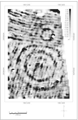 Magnetic gradiometry survey results showing a two barrows with surrounding ditches. (after Waddell et al., 2009) |
Magnetic gradiometry is carried out using magnetometers. A number of magnetometer sensors and configurations are available including fluxgate and caesium vapour sensors which can be configured in pairs as gradiometers. Standard fluxgate gradiometers measure the vertical gradient of the local magnetic field which can be influenced by shallow magnetic sub-surface archaeological features. More recent caesium vapour sensors can be configured in pairs as gradiometers to measure the vertical gradient of the Earth's total magnetic field. A single sensor can be used to measure the absolute value of the Earth's total magnetic field.
In practise there is little difference in the performance of the two sensor types when configured as gradiometers. Generally on smaller sites in Ireland fluxgate gradiometry is carried out with hand-portable single or twin gradiometers or with up to four gradiometers mounted on a pushed or towed cart. The gradiometer instruments directly measure variations in the magnetic gradient which are then interpreted to produce maps showing possible sub-surface archaeology. On very large sites arrays of single caesium vapour sensors are now routinely used in towed cart and sled-mounted systems to measure variations in the Earth's total magnetic field. In this case the magnetic gradient is derived from the field data and then interpreted to produce maps showing possible sub-surface archaeology.
The depth of investigation using the gradiometry technique can be up to 2m depending on the nature of possible sub-surface targets and the survey instrument used.
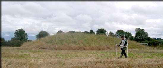
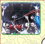
Twin fluxgate gradiometer (Photo: Kevin Barton)
Archaeological Geophysics
Techniques
| Airborne LiDAR
| Magnetic Susceptibility
| Magnetic Gradiometry
| Earth Resistance
| Electrical Resistivity Tomography (ERT)
| Ground Penetrating Radar (GPR)
| Metal Detection
| Electromagnetic Methods |
Contact DetailsLandscape and Geophysical Services |
|