

![]()
![]()
![]()
![]()
![]()
![]()
![]()
![]()
![]()


Archaeological Geophysics
|
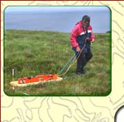
Ground Penetrating RadarGround Penetrating Radar (GPR) is a very high spatial resolution technique which allows two-dimensional time and depth sections or horizontal time and depth slices to be produced. The technique transmits pulses of electromagnetic energy into the ground and records their reflection or absorption by sub-surface features. It is a technique that can detect sub-surface features under tarmac, concrete etc. Depending on the targets sought, choice of antenna frequency, sampling interval and suitable ground conditions GPR can detect sub-surface features in the range of a few centimetres to about 10m. |
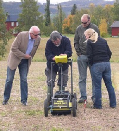
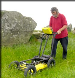 Cart-mounted ground penetrating radar (GPR). (Photo: Chris Randolph) |
Ground Penetrating Radar can detect possible archaeological features including:
- Caves, crypts, voids
- Souterrains
- Floors, masonry
- Ditches
- Walls

An oblique aerial view of a cropmark at Haug, near Stiklestad, Nord-Trondelag, Norway. (Photo by Eskil Fřlstad, June 2007).
Viewing the GPR response in
real time as the GPR antenna is pushed over the cropmark.
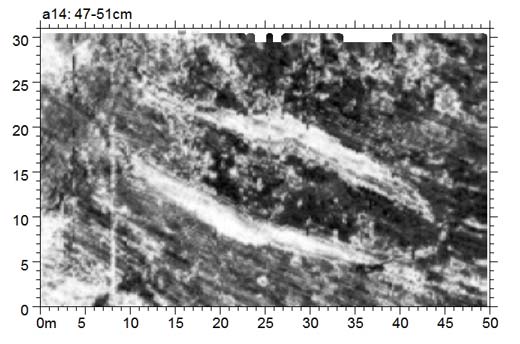
GPR horizontal depth slice from the cropmark survey showing enclosing
ditches of a possible longhouse associated with a grave. The combined depth slices
are animated in the movie below and simulate an excavation of the cropmark.
(adapted from Barton et al., 2009)
Reference
Barton, K., Stenvik, L. & Birgisdottir, B. 2009. A Chieftain"s Hall or a Grave: Ground Penetrating Radar in an Archaeological Geophysics Survey to Target the Excavation of a Cropmark near Stiklestad, Nord-Trondelag, Norway in R. Gómez Martin, A. Rubio Bretones, S.G. Garcia, M. Fernández Pantoja & C.M. de Jong van Coevorden (eds.) Proceedings of the 5th International Workshop on Advanced Ground Penetrating Radar IWAGPR2009, 27th - 29th May 2009, University of Granada, Granada, Spain, 159-164.
ISBN : 978-84-692-2661-2.
Archaeological Geophysics
Techniques
| Airborne LiDAR
| Magnetic Susceptibility
| Magnetic Gradiometry
| Earth Resistance
| Electrical Resistivity Tomography (ERT)
| Ground Penetrating Radar (GPR)
| Metal Detection
| Electromagnetic Methods |
Contact DetailsLandscape and Geophysical Services |
|